

30 Cool And Unusual Maps That Will Change Your Perspective On The World
Move over google maps there are a bunch of cooler maps in town!
I am sure that we are all familiar with the map of the world. It is a popular map, if not THE most popular (do not quote me on that though)!
But, if we are all being honest, it is kind of a boring map. Sure it has a lot of colours and detail, but it is not the most accurate representation of our planet—the size of many countries differs in reality.
Don’t worry though, there are a lot of really cool and interesting maps out there that just do not get enough credit. Maps are a great way to show and represent different things, so check out some cool maps below!
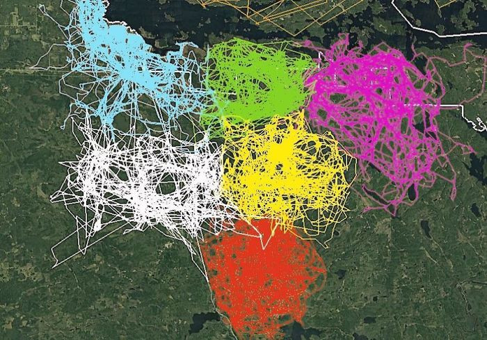
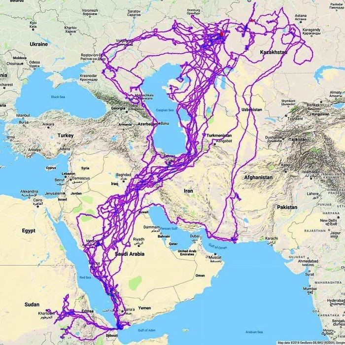
GPS tracking of wolf packs!
 john3806
[ADVERTISEMENT]
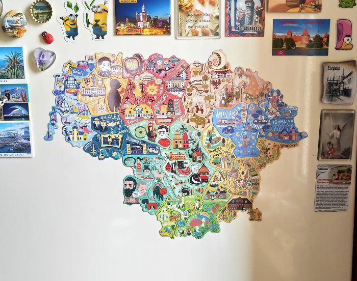
To encourage local tourism, Lithuania launched a campaign which included magnets that can only be obtained from each region
I love this.
 greycoconut
[ADVERTISEMENT]
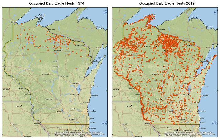
Bald Eagle nests! Check out that growth
 zstahowiak
[ADVERTISEMENT]
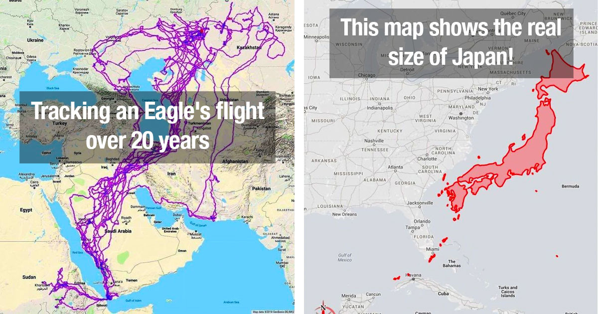
Tracking an Eagle's flight over 20 years
 HDeo950
[ADVERTISEMENT]
When a band announces a "word tour" but it's pretty much just a "North American plus Europe" tour
Aussies who don't live on the East Coast relate...
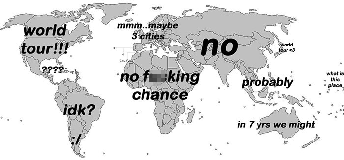 esloubro
[ADVERTISEMENT]
This map shows the real size of Japan!
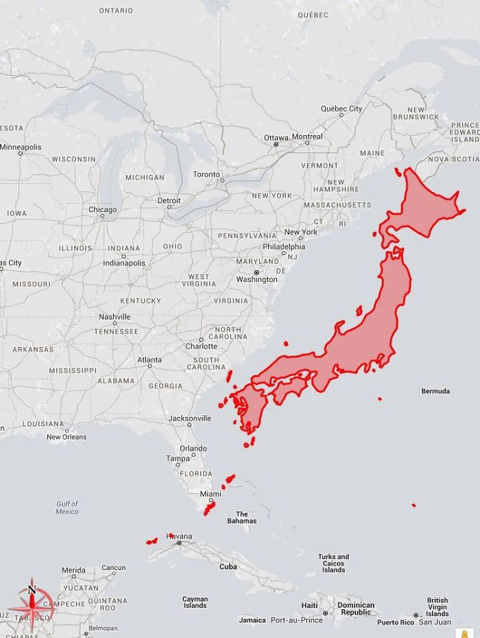 c0urso
[ADVERTISEMENT]
Let's just shake up the map: centre it on New Zealand instead!
 ParadoxicalCabbage
[ADVERTISEMENT]
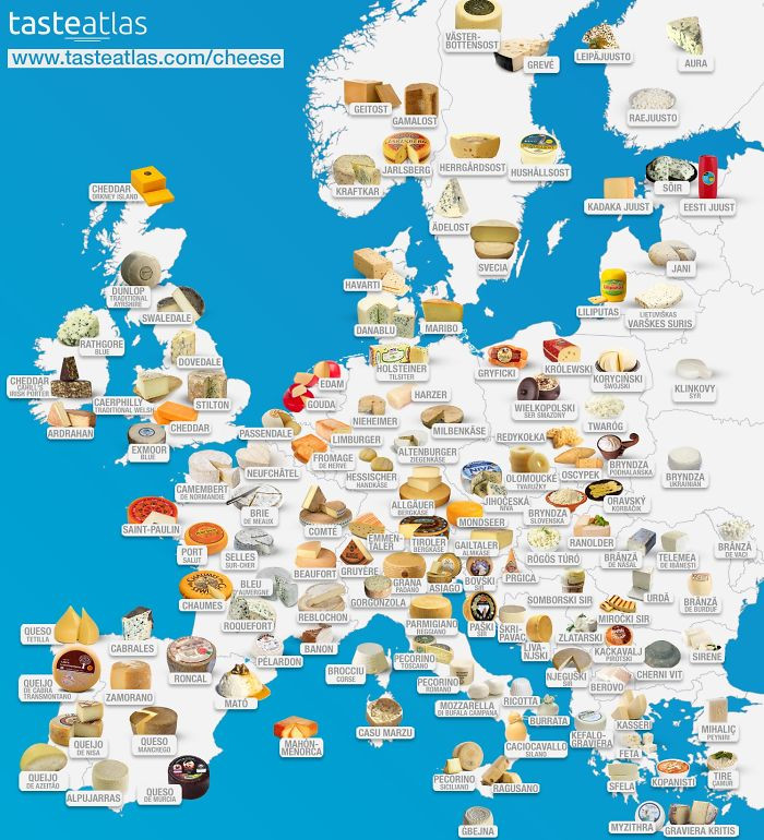
THIS MAP IS THE BEST: Europe, but cheese based!
Lactose intolerant people look away!
 dazzledvulture
[ADVERTISEMENT]
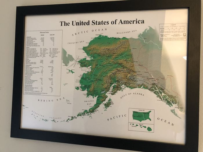
Alaska
 Pariahdog119
[ADVERTISEMENT]
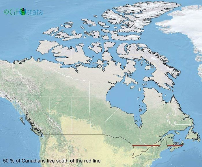
50% of Canadians live below that red line
 midlleeastcelts
[ADVERTISEMENT]
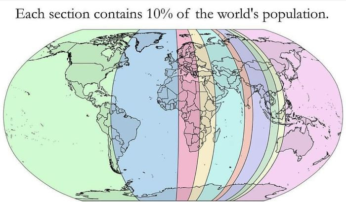
Each section has 10% of the global population
 AppleBiryani
[ADVERTISEMENT]
The countries in red are the places named in the bible
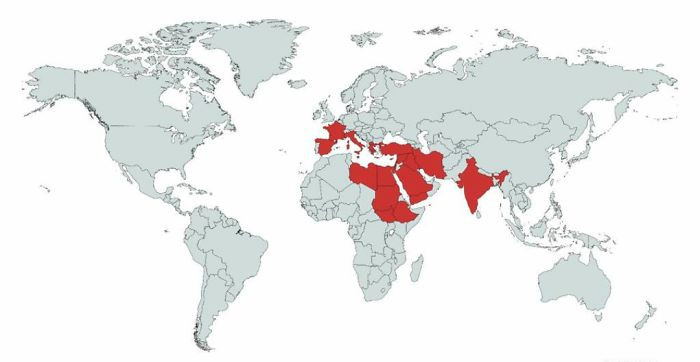 Erik_John09
[ADVERTISEMENT]
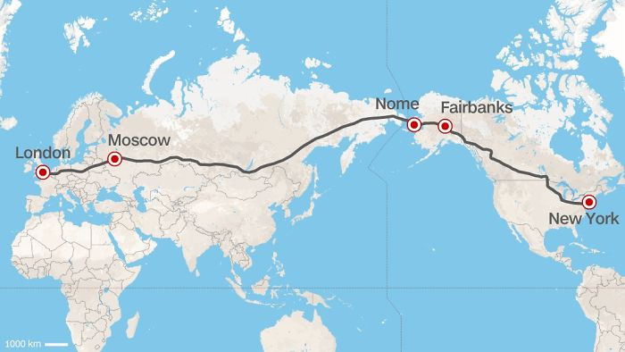
The longest possible train journey in the world!
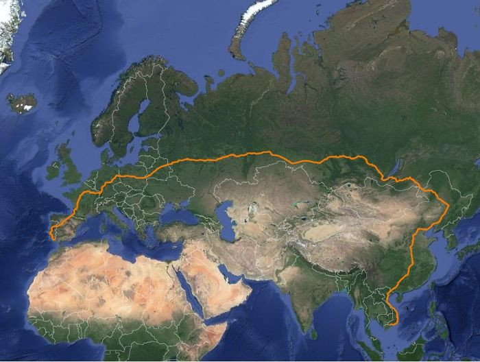 matias90
[ADVERTISEMENT]
The blue areas are the places where penguins are found naturally in the world
Yes, even Australia!
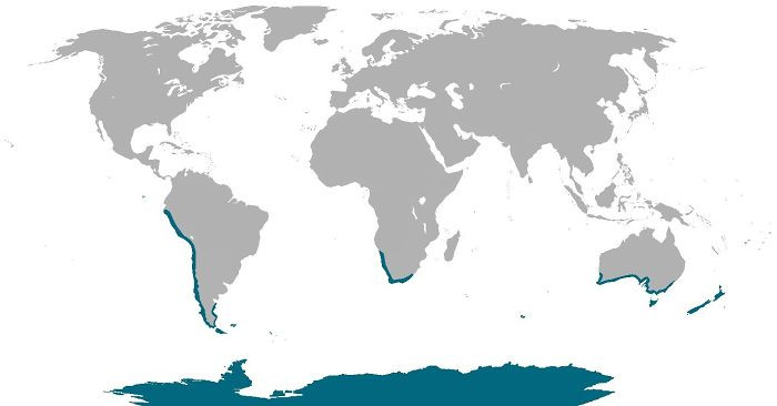 cheeseface35
[ADVERTISEMENT]
A size comparison between Australia and the US
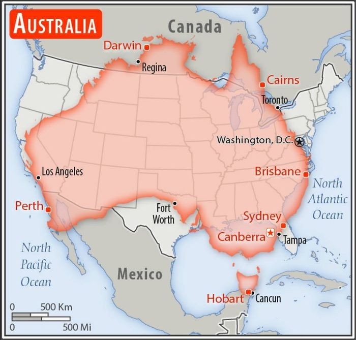 AJgloe
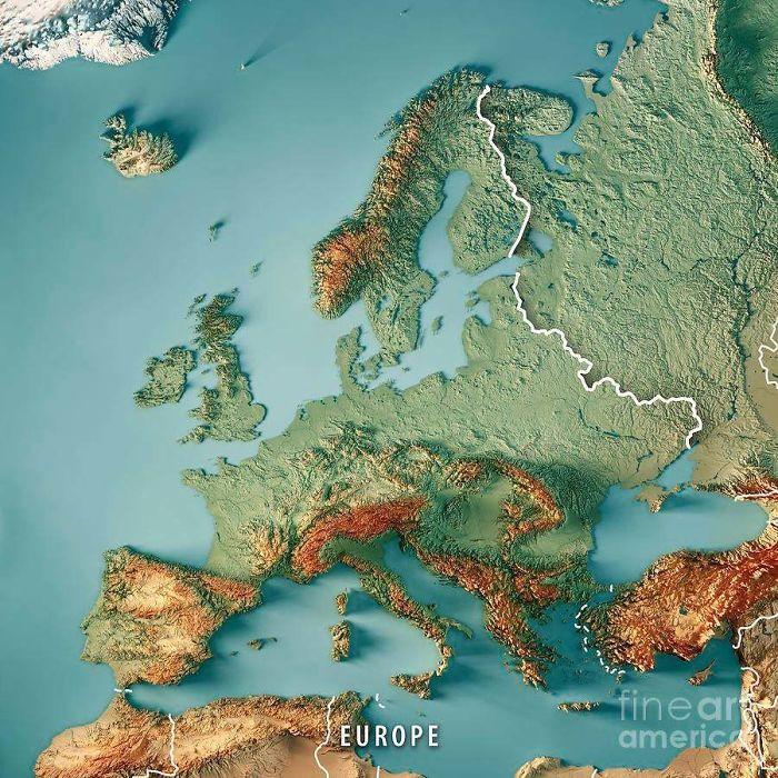
A 3d rendering of Europe!
 reddit.com
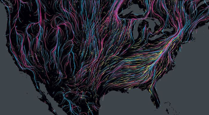
Animal migration routes in North America
 expatdoctor
A suggested highway route!
 emilylikesredditalot
This is what Mars would look like if (like Earth) 71% of its surface was covered in water
 crukey
The world's smallest country vs world's largest building
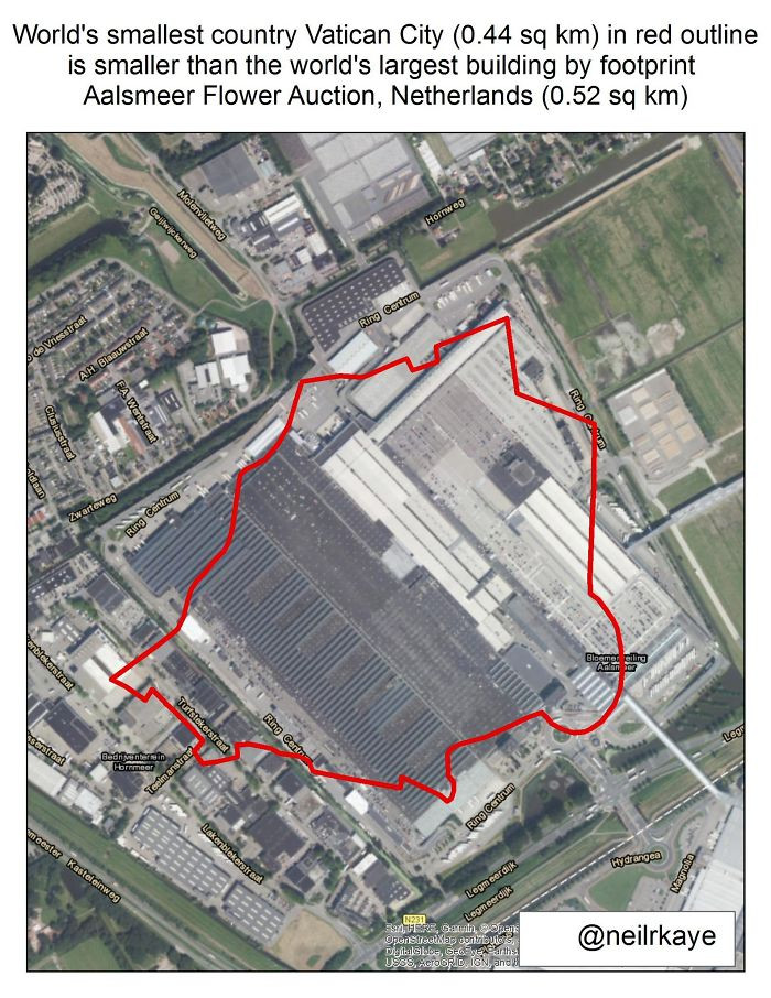 neilrkaye
Decline of native Irish speakers
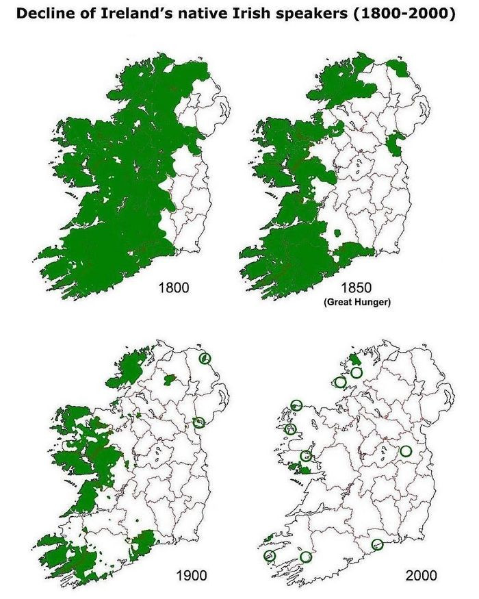 dumbcrow123
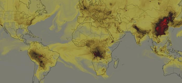
World's CO Emissions
:(
 reddit.com
#23 Locations Johnny Cash claims to have been to in "I've Been Everywhere"
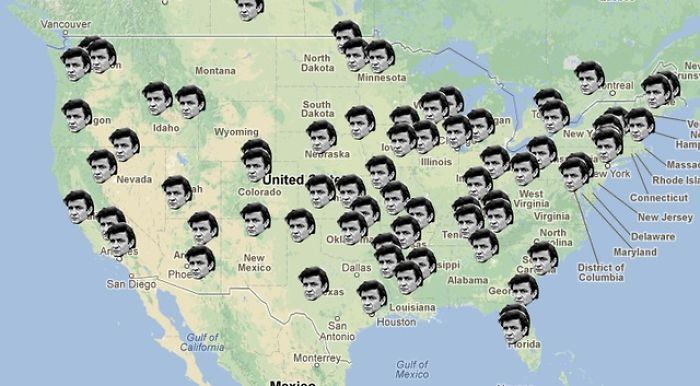 DaTingGoesSkraaa
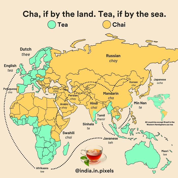
Different forms of tea/chai and where they acquired it, by land or sea
 reddit.com
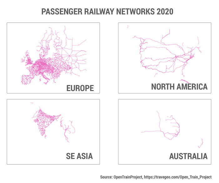
#25 Passenger railway networks 2020
 TraveGeo
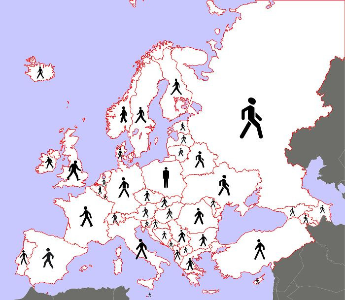
What the traffic pedestrian symbol looks like across Europe
 3OxenABunchofOnions
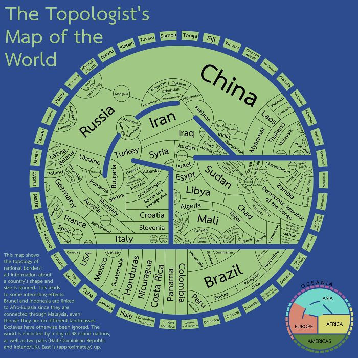
The topologist's map of the world: it shows borders and nothing else! Super cool!
 xilefakamot
These two areas of Africa have roughly the same populations
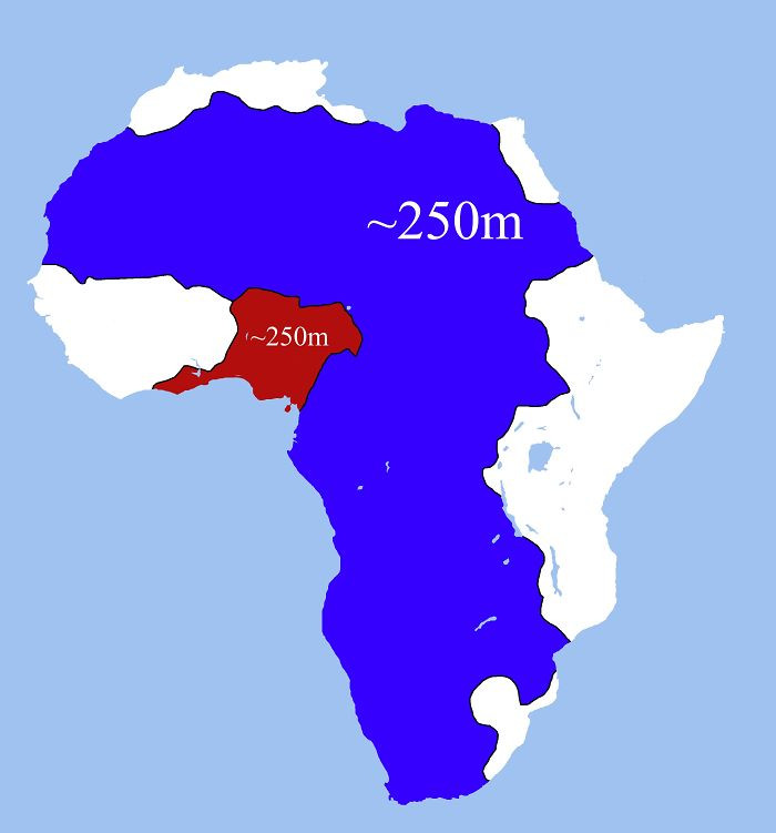 LlNES653
Roads on either side of the border: Russia and Finland
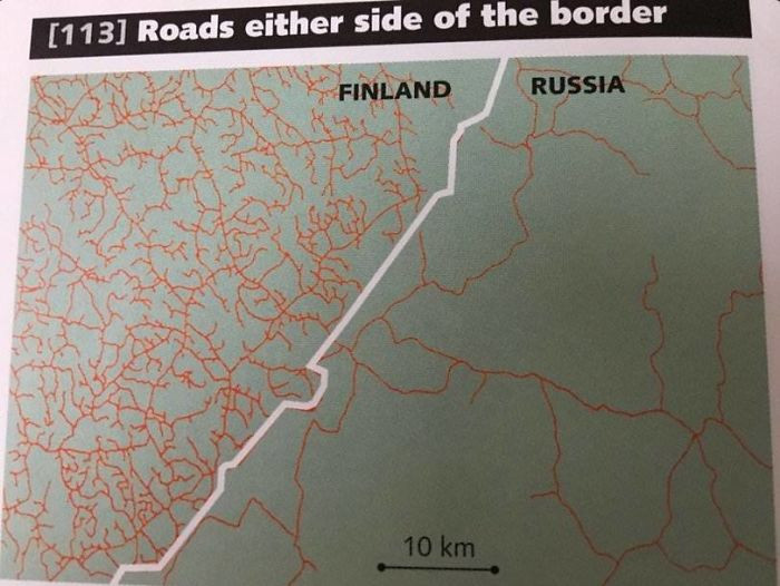 AJgloe
Syria before and after the civil war
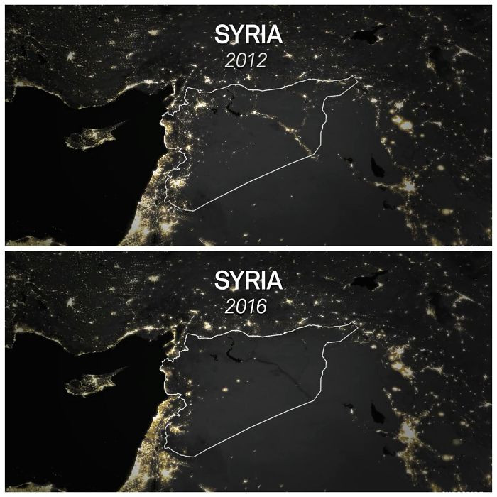 atharva321
Which map is your favourite? Or have you seen an even cooler map? Share your thoughts in the comments!
Rachel


